Saunders County NEGenWeb Project

STANDARD TIME.
Compiled for this work from Official Data by J. R. Dunham, Surveyor & D'ft'sman, Clinton, Iowa.| Explanation of Standard Time |
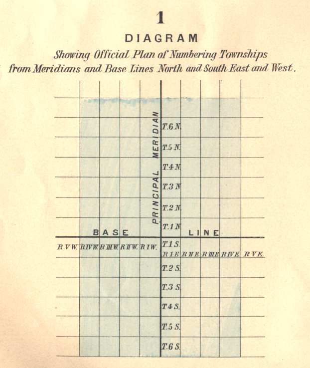
| Diagram 1 - Showing Official Plan of Numbering Townships from Meridians and Base Lines North and South East and West. |
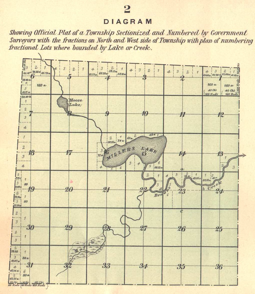
| Diagram 2 - Showing Official Plat of a Township Sectionized and Numbered by Government Surveyors with the fractions on North and West side of Township with plan of numbering fractional Lots where bounded by Lake or Creek. |
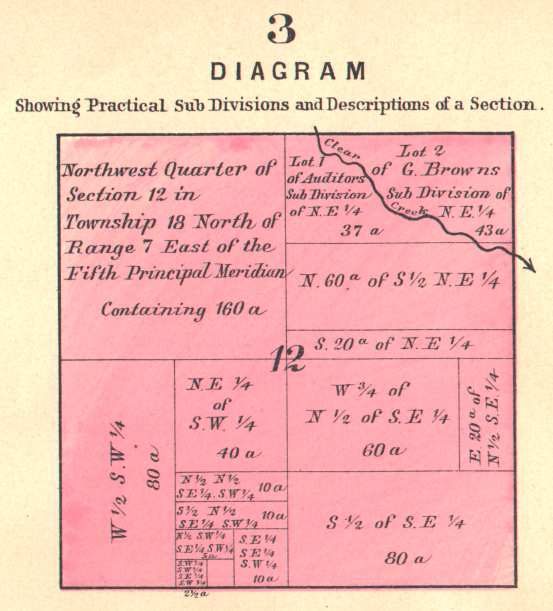
| Diagram 3 - Showing Practical Sub Divisions and Descriptions of a Section. |
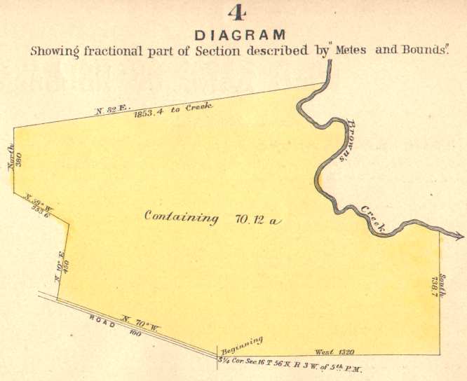
| Diagram 4 - Showing fractional part of Section described by "Metes and Bounds". |
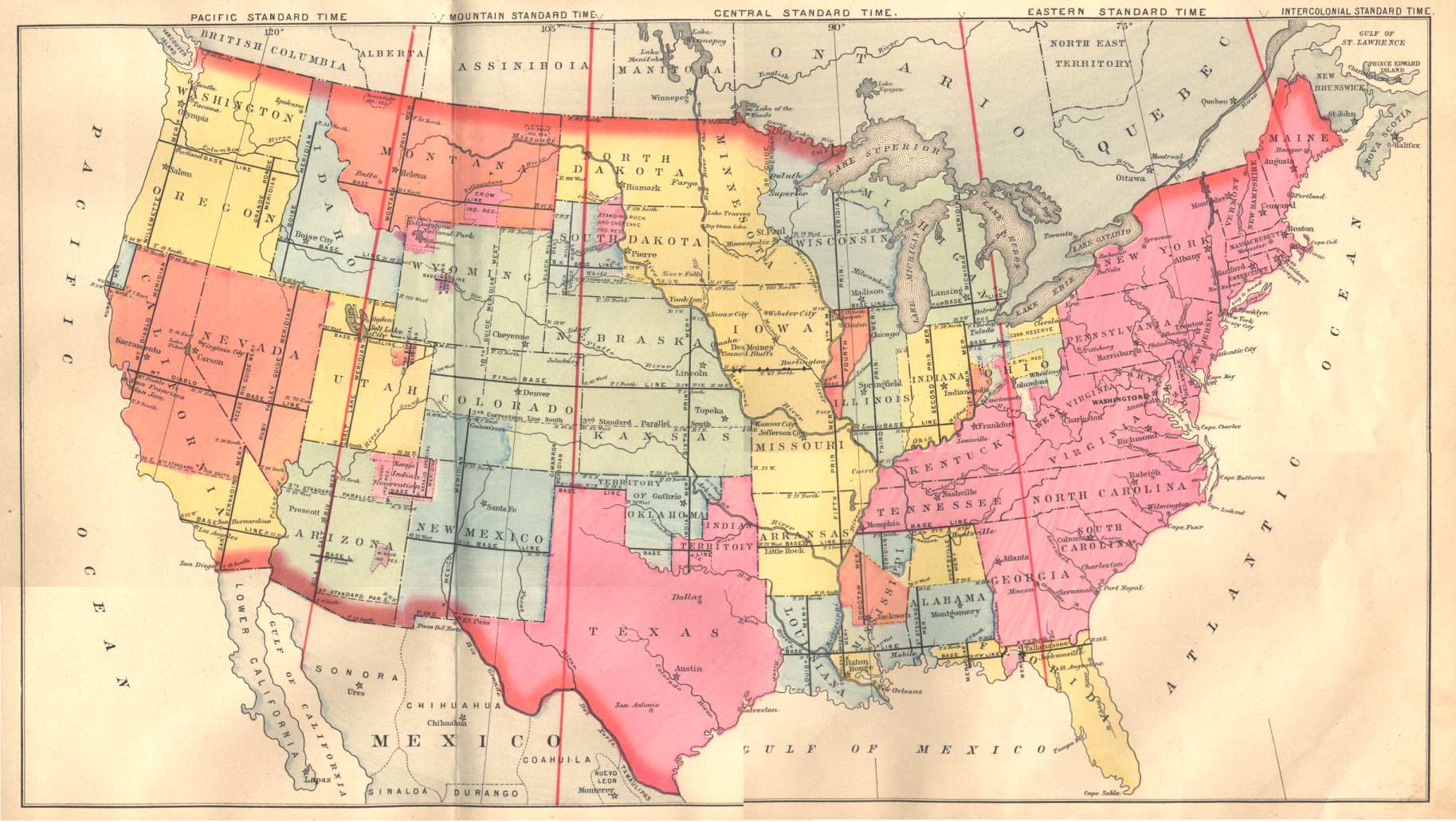 Map of Principal Meridians and Base Lines in the United States. |

