|
This index was compiled from various sources and includes information from obituaries.
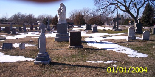
Photos submitted by Doris Counts, 2010
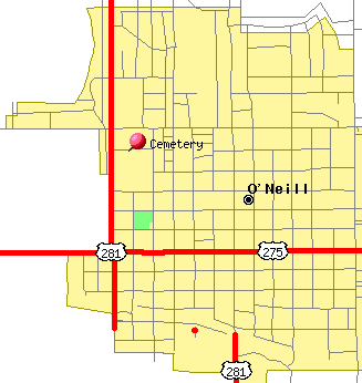
North of Pump and Pantry in O�Neill on Highway 281, about .5 miles. On the west side of the highway.
West edge of cemetery is bordered by Highway 281.
North edge of cemetery is bordered by W Hynes Street
East edge of Cemetery is bordered by N Madison Street
South edge of cemetery is bordered by W Adams Street.
N Jefferson Street runs north and south right through the middle of the cemetery.
Catholics are usually buried between N Jefferson and Highway 281
Protestants are usually buried between N Jefferson and N Madison.
There is a sign facing the highway in the southern half of this cemetery that says O�Neill Cemetery
The older graves are in the northern half.
The graves were first marked with wooden crosses, but they all burned in a prairie fire. So only iron and cement markers survived. That leaves areas between stones that look empty.
A |
B |
C |
D |
E |
F |
G |
H |
I |
J |
K |
L |
M |
N |
O |
P |
Q |
R |
S |
T |
U |
V |
W |
Y |
Z
|