| Cemetery | Latitude | Longitude | Remarks | |
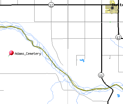
| Adams Cemetery | Map | 425214N | 0985810W | |
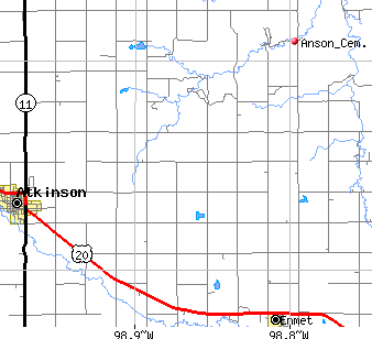
| Anson's Cemetery | Map | located 882 Road, 485 Ave - 9 miles east of Atkinson, 5 miles north | ||
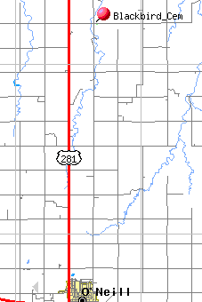
| Blackbird Cemetery | ||||
| Black Settlement Cemetery | ||||
| Blake Cemetery | ||||
| Calvary Cemetery | ||||
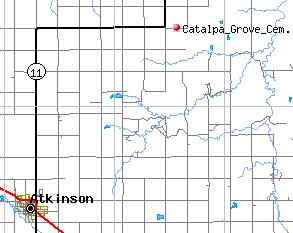
| Catalpa Grove Cemetery | Map | Nw corner of NE ¼ section 21, township 31, range 13 near the post offices of Catalpa and Richmond. | ||
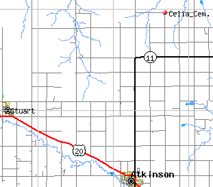
| Celia Cemetery Celia Cemetery* (2nd transcription) |
Map | 424145N | 0985554W | north of Atkinson to 888 Road and 478 Avenue |
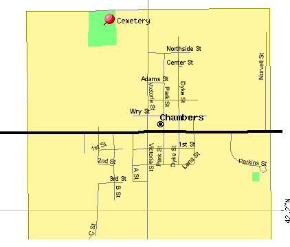
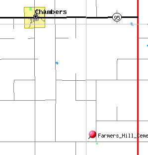
| Chambers Chambers War Memorial * * Transcription in the Holt County ALHN Project | Map | Chambers, Nebraska | ||
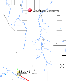
| Cleveland Cemetery | Map | 424634N | 0990634W | |
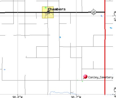
| Conley Cemetery - (Lutheran Cemetery) Conley Cemetery * * Transcription in the Holt County ALHN Project | Map | 420700N | 0984123W | From Chambers: south 5 1/2 miles, east 3 miles on south side of road |
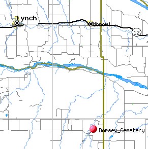
| Dorsey Cemetery - Dorsey Cemetery * * Transcription in the USGenWeb Archives Project (Apple Creek) | Map | 424032N | 0982003W | highway 281 north of O'Neill to 887th, turn east - 16 miles to 508 Ave and 887 Rd, follow signs, goes southeast about 3/4 mile |
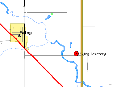
| Ewing Cemetery | Map | 421458N | 0981815W | |
| Farmers Hill Cemetery - Farmers Hill Cemetery * * Transcription in the Holt County ALHN Project | Map | 420704N | 0984152W | From Chambers - south 5 1/2 miles, east 2 1/2 miles on north side of road |
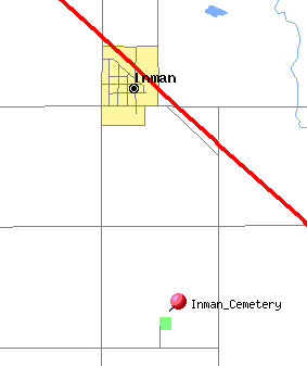
| Inman Cemetery * * Transcription in the Holt County ALHN Project | Map | 422112N | 0983126W | |
| Blackbird Cemetery
- Also Known as Joy Cemetery |
Map | 10 (11) miles north and one and ½ miles east of O'Neill, Nebr. NE ¼ of NW ¼, section 32, township 31, range 11 The Postoffice of Joy had a post office, black smith shop, and general store. After 1914 became known as Blackbird. | ||
| Lambert Cemetery | Map | 422548N | 0982019W | |
| Lutheran Cemetery | ||||
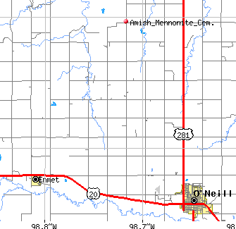
| Mennonite Cemetery | Map | located north of O'Neill, west on Highway 281 4 miles to gravel road (489 Ave), turn right follow road north to Cem (Rd 881) | ||
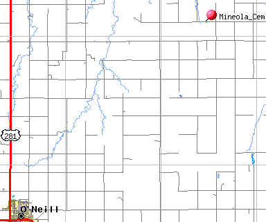
| Mineola Cemetery (Miniola) |
Map | 423638N | 0982710W | Located northwest quarter of northwest quarter of section two township 30 range 10. Original started 1886. The city of Mineola was located 6 miles northeast of Opportunity or 7 miles from Niobrara. |
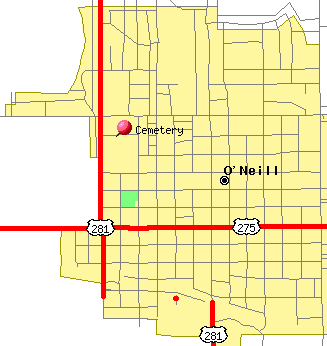
| O'Neill Cemetery - | Map | North of Pump and Pantry in O�Neill on Highway 281, about .5 miles. On the west side of the highway. West edge of cemetery is bordered by Highway 281. North edge of cemetery is bordered by W Hynes Street East edge of Cemetery is bordered by N Madison Street South edge of cemetery is bordered by W Adams Street. N Jefferson Street runs north and south right through the middle of the cemetery. Catholics are usually buried between N Jefferson and Highway 281 Protestants are usually buried between N Jefferson and N Madison. There is a sign facing the highway in the southern half of this cemetery that says O�Neill Cemetery The older graves are in the northern half. The graves were first marked with wooden crosses, but they all burned in a prairie fire. So only iron and cement markers survived. That leaves areas between stones that look empty. | ||
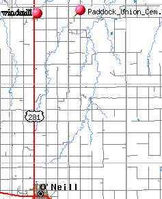
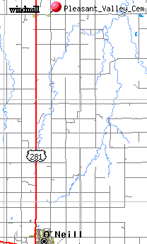
| Paddock Union Cemetery |
Map | These two cemeteries are located in Holt County, Nebraska. They are about 14 miles north of O'Neill, then about 1 miles east. There are two cemeteries on this road about ¼ mile apart, Paddock and Pleasant Valley. Pleasant Valley cemetery was established in 1890 Pleasant Valley- NE ¼ of NE ¼ Section 7, township 31, range 11 On the gate of the Paddock Union Cemetery are the following words: “In memory of Hon Frank Nelson State Sen 1949-1966” |
||
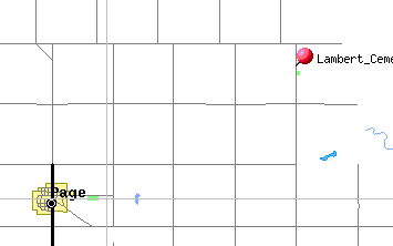
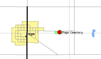
| Page Cemetery (Cherry Hill) | Map | 422401N | 0982415W | 1/2 mile east of Page, NE |
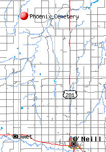
| Phoenix Cemetery 2006 partial listing Phoenix Cemetery 2010 index | Map | 424331N | 0984706W | |
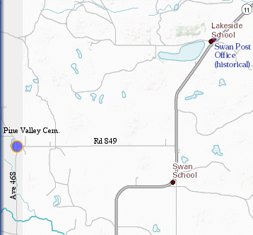
| Pine Valley Cemetery |
Map | Go south of Atkinson on Highway 11, 27 miles or to the substation, 472 avenue and 849 road
turn west 4 miles to 468 avenue and 849 road.
|
||
| Pleasant Valley Cemetery |
Map | These two cemeteries are located in Holt County, Nebraska. They are about 14 miles north of O'Neill, then about 1 miles east. There are two cemeteries on this road about ¼ mile apart, Paddock and Pleasant Valley. Pleasant Valley cemetery was established in 1890 Pleasant Valley- NE ¼ of NE ¼ Section 7, township 31, range 11 On the gate of the Paddock Union Cemetery are the following words: “In memory of Hon Frank Nelson State Sen 1949-1966” |
||
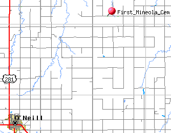
| Powell Grove Cem (First Mineola Cem) |
Map | ½ mile west of the larger cem, Section 3, township 30, range 10 | ||
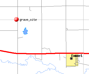
| Prairie Home Emmet |
Map | NW of Emmet, Nebraska | ||
| Prospect Hill Cemetery Prospect Cemetery* |
| |||
| Small Rural Cemetery | This small plot is on private land. You will need to get permission from the owner before visiting. This small cemetery is on a hill over looking the Niobrara River. Go straight north of O'Neill, till just about a mile from the river, turn west and follow the road, at the house, go into the pasture and in one of the small grove of trees is this cemetery. | |||
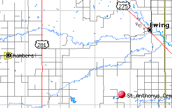
| Saint Anthonys Cemetery | Map | 420639N | 0982612W | |
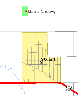
St. Boniface Cemetery 2006 St. Boniface Cemetery** **2nd Transcription in the Holt County ALHN Project |
Map | Stuart, NE Check both Stuart Community Cemetery and St. Boniface Cemetery for your names. | ||
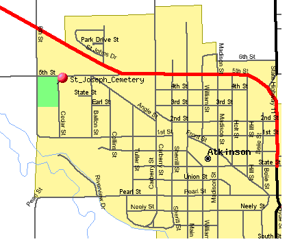
| St. Joseph Cemetery (2007) St. Joseph Cemetery (2006) St. Joseph Cemetery* *2nd Transcription in the Holt County ALHN Project | Map | Atkinson | ||
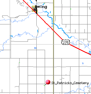
| Saint Patricks Cemetery * (Lutheran or Ziems) * Transcription in the Holt County ALHN Project | Map | 420747N | 0981917W | |
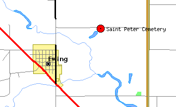
| St. Peter's Cemetery Saint Peter Cemetery (2nd transcription) |
Map | 421611N | 0981914W | |
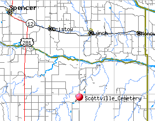
| Scottville Cemetery - Scottville Cemetery * *Transcription in the Holt County ALHN Project | Map | 424100N | 0983038W | Highway 281 north of O'Neill to 887th, turn east, 7 1/2 miles to 499 Ave and 887 Rd, then 1/2 mile east on north side of road |
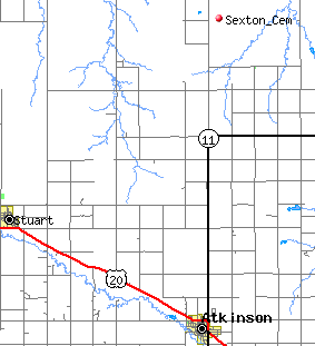
| Sexton - Adams | Map | SE ¼ of SW ¼ section 33 township 34 range 14 | ||
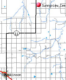
| Sona View - Sunnyview Cemetery |
Map | 1874-1902 located north of Atkinson, along the highway to Butte. SW ¼ of SW ¼ section 21 township 32 range 13 16 miles northeast of Atkinson on Highway 11 |
||
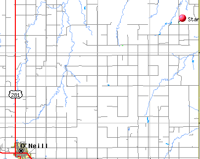
| Star Cemetery - | Map | 423827N | 0982038W | 884 Rd and 508 Ave on east side, north and east of Page |
|
Stuart Community Cemetery 2007 Stuart Community Cemetery 2006 (partial listing) |
Stuart, NE Check both Stuart Community Cemetery and St. Boniface Cemetery for your names. | |||
| Sunnyview Cemetery | ||||
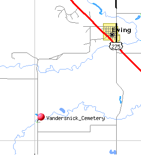
| Vandersnick Cemetery | Map | 421237N | 0982353W | |
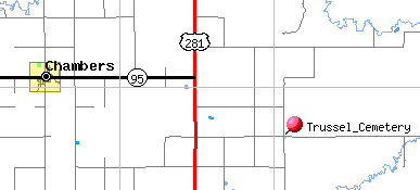
| Valley View Cemetery- Also Known as Trussel Cemetery | Map | 421031N | 0983532W | From Chambers: 4 1/2 miles east to highway 281, south 2 miles, 3 miles east, south side of road |
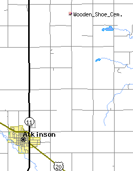
| Wooden Shoe Cemetery | Map | Holt | most of the graves were moved to Atkinson later. Located on Fred Jansen's land, two miles east and five miles north of Atkinson. Surrounded by lilac bushes. | |
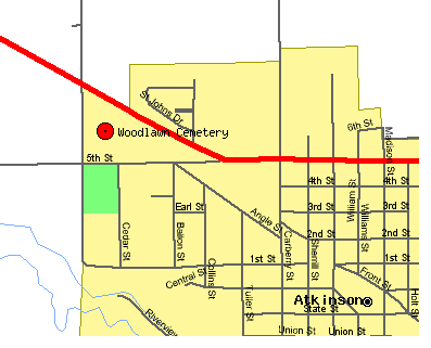
| Woodlawn Cemetery Woodlawn Cemetery** **Transcription in the Holt County ALHN Project | Map | 423216N | 0985922W | |
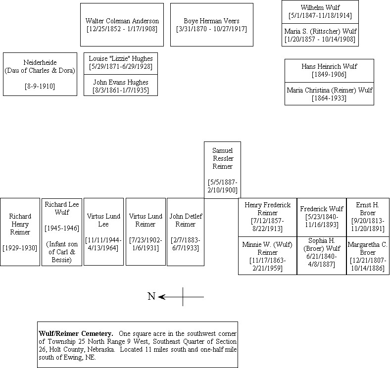
| Wulf-Reimer Cemetery | Map | 420613N | 0981946W |