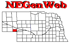
Deuel County NEGenWeb Project ©
1997, 1998, 1999, 2000, 2001, 2002 MHP & BAS


Deuel County
Note: Names appear without punctuation and business titles
are abbreviated.
NEBRASKA
STATE GAZETTEER AND BUSINESS DIRECTORY
Vol. XVI
Business Directory for 1917
POLK-McAvoy Directory Co., Omaha, Nebraska
|
BARTON. Deuel county. A station on the U P R R 6
miles n e of Julesburg Col the banking point and p o.
BIGSPRING. Pop 350. Deuel county. On the U
P R R 23 miles e of Chappell. Has Methodist, Lutheran and Presbyterian
churches, a bank, 3 hotels and a grain elevator. Land sells at $15
to $125 per acre. Ships wheat and live stock. Exp Am. Tel W
U. Warren B Beach P M.
-
Allen Austin R phys
-
Armstrong Jno barber
-
Big Springs Cemetery Assn Riley V Beach supt
-
Big Springs Mercantile Co T H Wolf pres J R Hamilton sec E C Wolf treas
gen store
-
Corner Pharmacy Edw L Moore mngr drugs
-
Doran Frank gen store
-
Farmers Co-operative Assn Edw J Hackney mngr harness
-
FARMERS STATE BANK (Capital $12,000 Surplus $3,000) Andreas Kjeldgaard
Pres E A Phelps Vice Pres Carl Kjeldgaard Cashr
-
Gates & Alman (Ivy L Gates Arvid Alman) pool
-
Grannell Jno W pool
-
Harder Carl harness
-
Holcombe Jas R real est
-
Jensen Mercantile Co A L Jensen pres W B Beach sec gen store
-
Johnson & Burns (Jno C Johnson Jno Burns) barbers
-
JUNGE BROS (George E and M F) Real Estate Loans Farm and Ranch Lands
and Insurance
-
JUNGE GEORGE E Attorney at Law
-
KJELDGAARD ANDREAS Pres Farmers State Bank Insurance Agt and Notary
Public
-
McGrath Alb J r r exp and tel agt
-
Mecham Oliver N vet surgeon
-
Murdock Alb restaurant
-
Phelps Hotel Mrs Sarah E Phelps propr
-
PLUMMER HOUSE THE Agnew G Ryburn Propr (See
adv)
-
Remington Hotel Merrie C Remington propr
-
RYBURN AGNEW G Propr The Plummer House (See
adv)
-
Smith Clinton H phys
-
Thompson T Greer livery
-
Thurnagle Wm F garage
-
Waterman Henry automobiles
CHAPPELL. Pop 650. Deuel county. The county seat
on the U P R R 42 miles w of Ogallala. Has Methodist and Catholic
churches, 2 banks, 2 hotels, a commercial club, an opera house, 2 grain
elevators, an electric light plant and water works. A weekly newspaper,
The Register, is published. Land sells at $20 to $65 per acre.
Ships grain and live stock. Exp Am. Tel W U. Wm E Roudebush
P M.
-
ADAMSON & TEAGARDEN (Henry Adamson Wm A Teagarden) Real Estate
Farm Loans and Insurance (See adv)
-
Bailey Thos D barber
-
Chappell Cemetery Assn H I Babcock sec
-
Chappell Community Club L O Pfeiffer pres H I Babcock treas
-
Chappell Electric Light & Water works R H Libby supt
-
Chappell Hotel Benj Williams propr
-
Chappell Lumber & Hardware Co (Jas Peterson Joshua L Brown M Peter
Jensen)
-
Chappell Mercantile Co H C Heming mngr gen store
-
Chappell Register The Guy C Neumann pub
-
Chappell State Bank The (capital $15,000) H G Wiegand pres E C Wolf cashr
-
Chappell Telephone Exchange H I Babcock pres J R Wertz sec and treas
-
Corpe Chas barber
-
Doran Jno T vet surgeon 10 miles n e
-
Farmers Elevator Co C H Bennett mngr
-
First National Bank (capital $25,000) J R Wertz pres H I Babcock cashr
-
Fulton Benj barber
-
Gibson Fred H produce
-
Hanley Homer drugs
-
Hill Jesse R real est
-
Hewitt Fred E restaurant
-
Hurst Opera House Fred J Hurst
-
Johnson & Gyger (Henry A Johnson Chris C Gyger) hardware
-
Kauffman Jos A restaurant
-
LeSelle Bros (Grosvenor G and Glenn S) gen store
-
Lund Jess pool
-
McAuliff & Son (Frank and Jno) gen store
-
McCONAUGLEY CLYDE L Real Estate Farm Loans and Insurance
-
McCORMICK JOHN G Bonded Abstracter Notary Public and Conveyancer
-
McPheeters Orin O automobiles
-
Millikan Andr A livery
-
Neumann Guy C pub The Chappel Register
-
Nichols Geo meats
-
Olson Edw W automobiles
-
Patty & Vandiver (Marion B Patty Leslie E Vandiver) phys
-
Pfeiffer Luther O lawyer
-
Resler Chas N furniture
-
Richey Land Co (Wm O Richey Rob F McGrale Roy Townsend)
-
Stone Hotel Mrs Alice Themar propr
-
Terry Scott W county surveyor
-
Themar Mrs Alice propr Stone Hotel
-
Thompson Hilmer J drugs
-
Thompson Wm H r r exp and tel agt
-
Trans-Mississippi Elevator Co R E [or B] Williams mngr
-
Welkum Geo harness
-
Wertz Bros (Jno R and Wm F) real est
-
Wertz Roosevelt W meats
-
Western Lumber Co Wm McCartney mngr
-
Williams Benj propr Chappel Hotel
-
Wolf & Barnes (Jos Wolfe Riley R Barnes) blksmiths
-
Woolf Isaac county judge
-
Zehr Nicholas E produce
PERDU. Deuel county. A station on the U P R R 4 miles
s e of Lodge Pole the banking point and p o.
RALTON. Deuel county. A station on the U P R R 5
miles s e of Chappell the banking point and p o.
If you are having problems with this page please contact usLinda Ziemann and David Gochenour
This page was last modified on July 30, 2022
Return to the NEGenWeb Deuel County main
page.


